
Aerial Orthomosaic — Site Reference
The full site from above · 07/05 orthomosaic. Drag to pan, scroll to zoom. · Web-reduced for speed — full-resolution ortho on file.
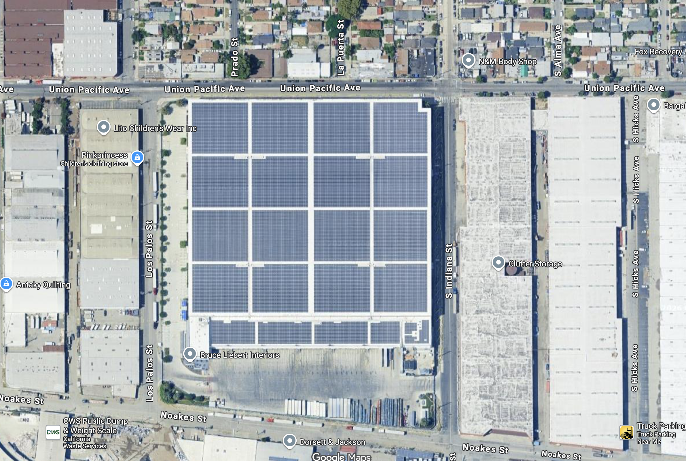
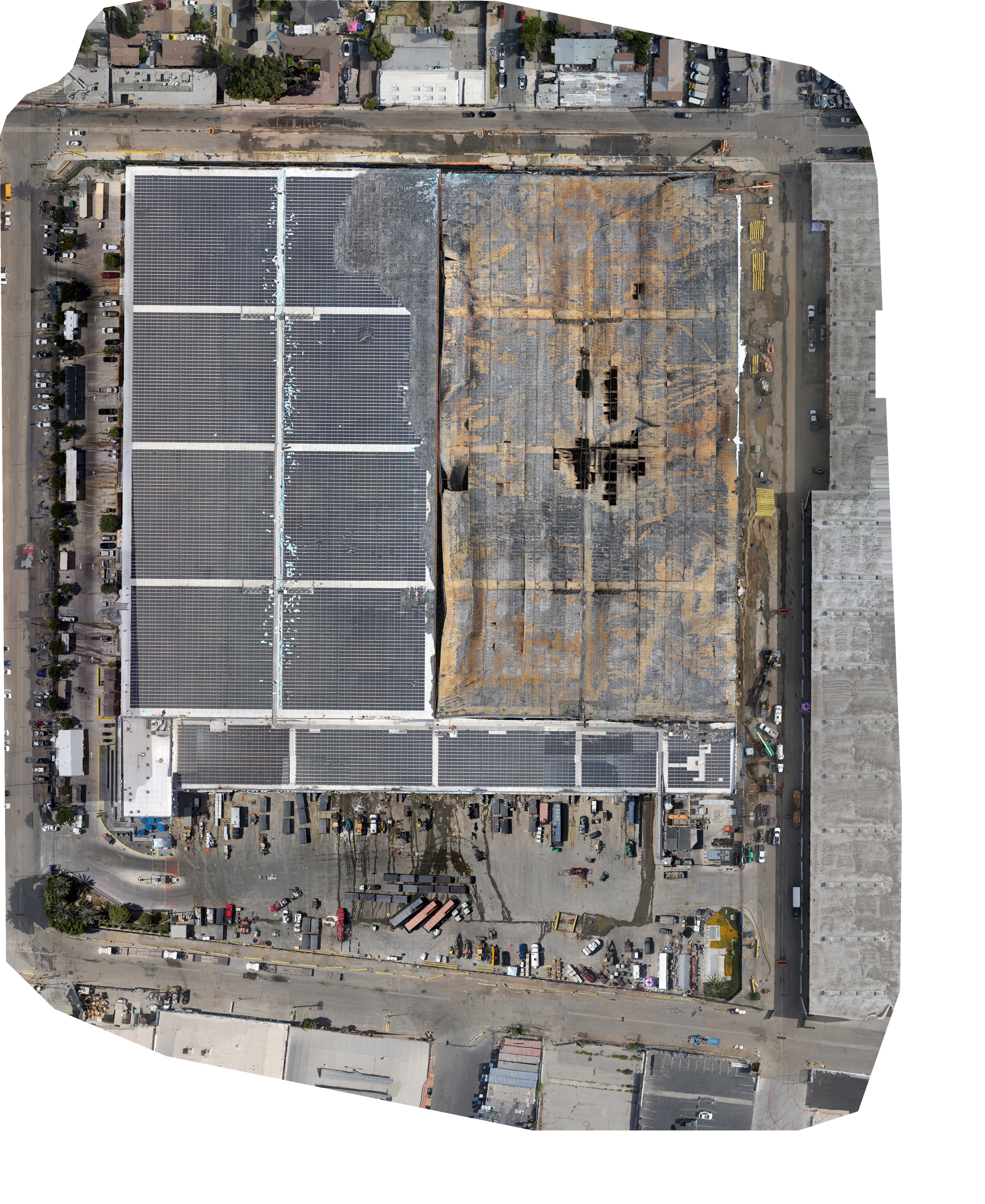
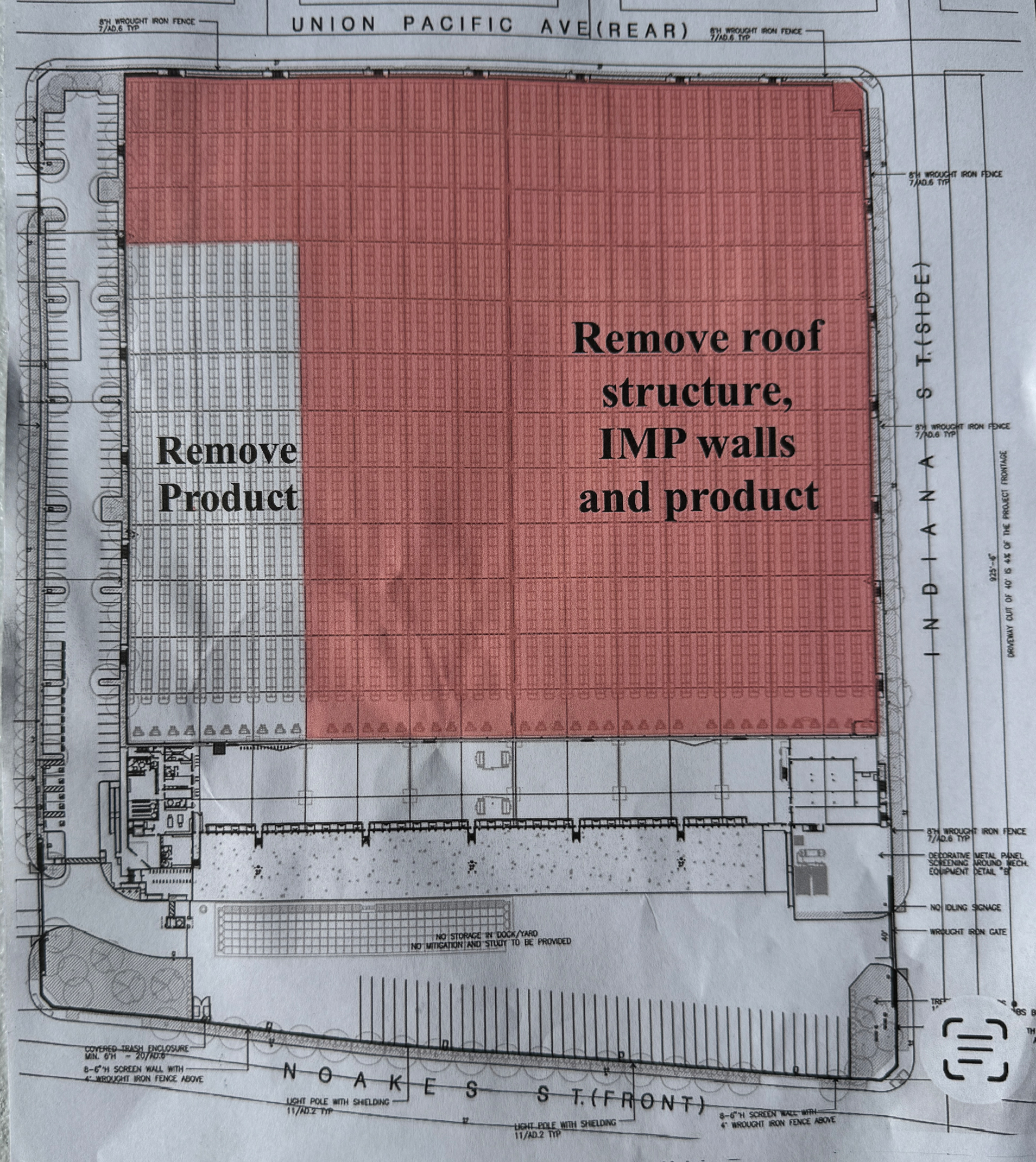
Image Adjust
Ortho opacity100%
Brightness0
Contrast0
Plan Overlay
Transparency50%
drag to pan · scroll to zoom
‹ Gallery · 360°
Preview a 360° panorama here
Drag your equirectangular JPG onto this box to see how this row will look. In the finished app each row loads its own pano, with arrows to walk down the aisle.
Exterior 360° · click a tile to step inside the panorama
Photos · Row 2 — Damage
FPV Flights · Row 2
Row 2 — Flight Pass
Select a height on the right → that 600 ft end-to-end pass plays here (smooth 1080p proxy; 4K original on the drive).
Flight height
Lidar · Point Cloud · 20.3M pts · drag to orbit
3D Mesh · textured model · drag to orbit · full-res · web-optimized (Draco)
Row A · interior photos & flight videos
Live Stream · real-time drone feed
● NO SIGNAL
LIVE STREAM NOT AVAILABLE
Awaiting drone feed — no active broadcast
Air Monitoring · gas & particulate mapping
SAMPLE DATA
Air Quality
LowHigh
NH₃ · TVOC · CO · H₂S · PM2.5 · CH₄
Sample data · for demonstration only
Before / After · · drag the divider
‹ ›
Before · Google Earth
After · 07/05
Align after
Report Export · branded PDF deliverable
PDF
Site Assessment Report
Generate a branded, print-ready PDF — site details, aerial imagery, and findings in one document.
Opens your print dialog — choose “Save as PDF”.
Project Crew · UAV flight crew & project contacts
Project Crew
UAV flight crew & project contacts.
This section will expand as the project grows — additional crew, pilot certifications, and direct contact details will be added here.
1 / 7—